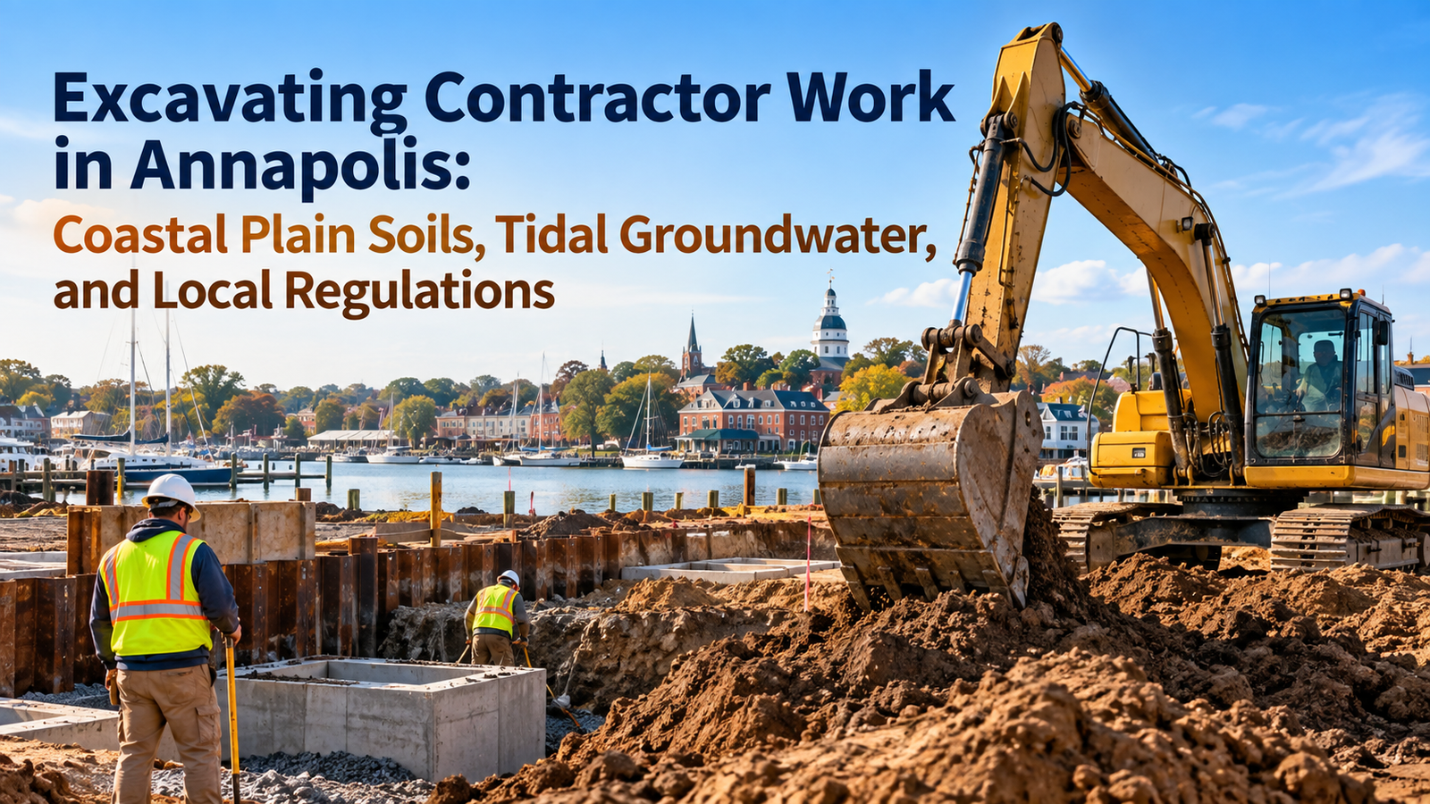
Excavation in Annapolis is not like excavation in most of Maryland. The city occupies a peninsula of Coastal Plain geology at the edge of the Chesapeake Bay, and the combination of unconsolidated soils, shallow groundwater, tidal influence on subsurface hydrology, and environmental regulations that apply to the entire Critical Area makes every below-grade project a technical exercise that goes well beyond moving dirt.
An Excavating Contractor Annapolis operating in Annapolis must understand how the soils behave under load, how the water table fluctuates with seasons and tidal cycles, what permits apply to different types of excavation, and how the requirements of the Chesapeake Bay Critical Area Law constrain work near the shoreline. This article walks through each of those dimensions for property owners, developers, and builders trying to understand what professional excavation in Annapolis actually involves.
The Soil Profile Beneath Annapolis
The Coastal Plain physiographic province extends from the Fall Line roughly the I-95 corridor through Baltimore south and east to the Atlantic coast. Annapolis sits well within this province, and its soils reflect the sedimentary character of the region. The uppermost horizons typically consist of sandy loams, loamy sands, and silty clays deposited by ancient river and marine systems. These soils are loose and unconsolidated compared to the weathered crystalline rock soils found in Piedmont counties to the west.
In the downtown and waterfront areas, natural soils are overlaid by historic fill. When colonial settlers expanded the Annapolis waterfront in the seventeenth and eighteenth centuries, they filled tidal flats and marsh areas with whatever material was available rubble, oyster shells, excavated soil from building projects, and organic waste. This historic fill is poorly engineered, heterogeneous, and often contains organic material that compresses under load and produces unpredictable settlement.
Beneath the fill and the natural Coastal Plain sediments, Annapolis sits on the Aquia Formation and the Nanjemoy Formation Eocene-age marine sediments that include fine sands, glauconitic clays, and occasional shell beds. These deeper formations are relevant primarily to utility excavations and deep foundation systems, but their groundwater bearing characteristics affect dewatering requirements at all depths.
Groundwater and Dewatering in Annapolis Excavations
The water table in Annapolis is close to the surface across most of the city. In the lower elevations near Spa Creek, College Creek, and the Severn River shoreline, the saturated zone can begin within three feet of finished grade. Even in higher-elevation neighborhoods like Bestgate and the Route 2 corridor, seasonal groundwater fluctuations bring the water table close enough to the surface to affect shallow utility trenches and foundation excavations during wet periods.
Excavations that penetrate below the water table require dewatering the controlled removal of groundwater from the excavation to maintain stable, workable conditions. The most common dewatering method in Annapolis is wellpoint dewatering, where a series of small-diameter wells installed around the excavation perimeter continuously pump groundwater to a header pipe connected to a centrifugal pump. Wellpoint systems can lower the water table several feet below the excavation bottom, providing the dry working conditions needed for foundation work, utility installation, and backfill.
Discharging dewatering effluent requires coordination with the Maryland Department of the Environment. Groundwater from Annapolis excavations may contain naturally occurring iron, manganese, or chlorides, and discharge to storm drains or surface waters requires a permit under the Maryland Waterway Construction Permit program. In some cases, sediment basins are required to settle turbidity before discharge. The dewatering plan is typically prepared by a geotechnical engineer and submitted with the permit application.
Chesapeake Bay Critical Area: Excavation Rules Near the Shoreline
All land within 1,000 feet of tidal water and tidal wetlands in Annapolis falls within the Chesapeake Bay Critical Area. Given the city’s peninsula geography, this designation covers a substantial portion of the developed area. Excavation within the Critical Area is subject to regulations administered jointly by the City of Annapolis Department of Planning and Zoning and the Maryland Critical Area Commission.
Within the 100-foot shoreline buffer the most restrictive Critical Area zone ground disturbance is generally prohibited unless it is for water-dependent uses such as piers, boat ramps, or shore erosion control. Buffer averaging and mitigation plans can provide some flexibility, but excavation in this zone for utility work or building construction requires exceptional justification and detailed mitigation proposals.
Beyond the buffer but within the 1,000-foot Critical Area, sediment and erosion control plans are mandatory for all disturbed areas. Bare soil must be stabilized within 48 hours of final grading. Nutrient runoff from disturbed soils is a regulated pollutant in the Chesapeake Bay watershed, and Critical Area permits may require bioretention, rain gardens, or other best management practices to be installed as part of the excavation and restoration scope.
Excavation Permits and Review in Annapolis
Excavation permits in Annapolis are issued by the City of Annapolis Building Department. The permit application must include site plans showing the extent of disturbance, a sediment and erosion control plan stamped by a licensed engineer, and for projects in Critical Area zones, documentation of compliance with the Critical Area management plan for the property.
Grading permits are separate from building permits and are required for any earth-moving activity that exceeds defined thresholds of disturbed area or grade change. The specific thresholds are set in the city’s Grading and Sediment Control Ordinance. Projects that disturb more than 5,000 square feet of land require a grading permit and a full E&SC plan regardless of whether a building permit is also required.
For projects near tidal water, a Maryland Department of the Environment Wetlands and Waterways Permit may also be required if excavation affects tidal or nontidal wetlands, or if fill or structures are proposed in the 100-year floodplain. The floodplain in Annapolis has been remapped several times in recent decades as sea level rise models have been incorporated into FEMA’s Flood Insurance Rate Maps, and what was previously outside the floodplain in older maps may now fall within it.
Utility Excavation in the Historic Core
Utility excavation in downtown Annapolis involves particular care because of the density of existing underground infrastructure and the potential for archaeological deposits. The city has a complex underground environment: water mains, sewer lines, gas distribution mains, electric conduits, telecommunications ducts, and private service laterals all share the subsurface beneath streets that have been in continuous use for more than three hundred years.
Before any utility excavation in the historic core, 811 notification and utility marking is required. Private utility locating services are used to identify lines not covered by the 811 system. Hand excavation is required in the vicinity of marked utilities, and excavation machinery should not be used to break through pavement or initial soil layers without confirming utility clearances.
Archaeological deposits are documented across much of the historic downtown. Annapolis is one of only a small number of American cities with a municipal archaeological program, and the city’s Department of Planning and Zoning maintains records of archaeological sensitivity zones. Utility excavations in these zones may require an archaeologist to monitor the work. When cultural material is encountered, work stops and the archaeologist documents and stabilizes the find before excavation continues.
Structural Excavation and Shoring Systems
Deeper excavations in Annapolis for basements, underground parking, elevator pits, and deep utility structures require engineered shoring systems to retain the excavation walls. In the loose Coastal Plain soils, unsupported excavation walls are unstable at depths as shallow as four feet in wet conditions and eight feet in dry conditions. OSHA’s excavation safety standards set minimum requirements, but in Annapolis the site-specific conditions often require engineered shoring beyond what the OSHA tables prescribe.
Common shoring systems in Annapolis excavations include timber sheeting driven in advance of excavation, steel sheet piling for larger cuts, and soldier pile and lagging systems for deep excavations with permanent retention needs. Each system has cost, schedule, and performance implications that a geotechnical engineer evaluates in the context of the specific soil profile, groundwater conditions, and adjacency constraints.
When an excavation is adjacent to an existing building a common situation in the dense downtown underpinning may be required to extend the existing foundation below the level of the new excavation. Underpinning is engineered on a case-by-case basis and is executed in alternating bays to prevent overstressing any portion of the existing foundation during the process.
Frequently Asked Questions: Excavating Contractor Services in Annapolis
Why is excavation more complicated in Annapolis than in surrounding counties?
The combination of shallow groundwater, Coastal Plain soils prone to instability, Chesapeake Bay Critical Area regulations, historic fill in the downtown, and archaeological sensitivity creates a regulatory and geotechnical environment more complex than in most Maryland jurisdictions.
What is the Chesapeake Bay Critical Area, and how does it affect excavation permits?
The Critical Area is all land within 1,000 feet of tidal water. Within this zone, excavation requires compliance with buffer rules, sediment and erosion control plans, and in some cases MDE Waterways permits. The 100-foot shoreline buffer carries the most restrictive rules.
Does groundwater always need to be managed during excavation in Annapolis?
Not always, but it frequently does. In low-elevation areas near tidal water, the water table may be encountered within a few feet of the surface. Dewatering systems are sized to the specific groundwater depth and soil permeability. A geotechnical investigation determines what dewatering method is appropriate.
Are archaeologists required on excavation projects in Annapolis?
In designated high-sensitivity zones in the historic core, archaeological monitoring may be a permit condition for below-grade excavation. The requirement is determined by the city’s Department of Planning and Zoning based on the location and depth of the proposed work.
What permits are required for excavation in Annapolis?
City of Annapolis grading and building permits, MDE Sediment and Erosion Control approval for disturbed areas above certain thresholds, and in Critical Area zones, compliance with the Critical Area Management Plan and potentially MDE Wetlands and Waterways permits.
Excavation contracting in Annapolis demands a combination of geotechnical knowledge, environmental regulatory literacy, and operational experience with the specific soil and groundwater conditions of the Chesapeake Bay Coastal Plain. Projects executed with full awareness of these requirements produce stable, code-compliant, environmentally responsible results that meet both the engineering and regulatory standards of one of Maryland’s most carefully managed built environments.